


First Community Canoe of 2023!
Saturday, February 25th, 1-5pm Community Canoe Daytrip Adventure Helena Harbor round trip to Buck Island. (Next one is Sat March 18th, 1-5pm, from Clarksdale.)

Our First Community Canoe Daytrip Adventure of the year is tomorrow, Saturday, February 25th, 1-5pm from the Helena Harbor round trip to Buck Island.  Special opportunity for those who have never paddled on the Mississippi River!  Free for youth under 18.  1/4 price for educators. 1/2 price for adults.  Reservations required!  Automated signup here.  It will be brisk and breezy, so dress appropriately.  Forecast: cloudy, North wind 5-10.  We'll find sheltered place to make landing on Buck Island, build a fire, brew some Yaupon tea, and explore island.  Helena Harbor GPS: 34.52196250015302, -90.58215559939534.  Made possible through a partnership with the Lower Mississippi River Foundation.  Dedicated to fostering long-term stewardship of the big river through its youth.
Complete description and signup, and what to pack, found below.
Lower Mississippi River Dispatch No. 899
"Voice of the Lower Mississippi River"
Memphis, TN ~ Helena, AR ~  Clarksdale, MS ~ Vicksburg, MS
Photos & Text (c) 2023 John Ruskey
Buck Island Roundtrip Adventure
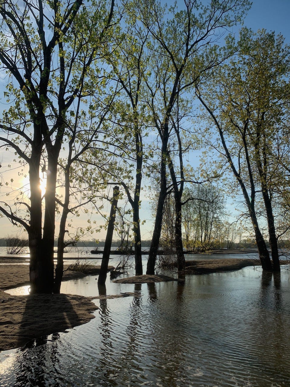
The Buck Island Adventure is a roundtrip voyageur canoe paddle on the biggest river in North America, the Mighty Mississippi, involving a tour of an archipelago of Mississippi River Islands with big beaches, swim holes, birds, turtles, and other wildlife. This round trip paddle affords an incredible variety of giant sandbars, wetlands, gravel/fossil bars, deep willow forests, and miles of beaches to swim from or walk along. So — a little bit of everything!
Buck Island is a 1,498 acre island located 1 mile upstream of the mouth of the Helena Harbor. It is one of the big islands of the Lower Mississippi. At low water its sandbars stretch 5 miles north to south and 1 ½ miles east to west. The forested high ground of the island is approximately 2 miles tall and a mile wide, in kind of a half moon shape, with a smaller forested “splinter island” found to the east. (During low water this splinter island becomes joined to the main island by a wide valley of sand & muddy pools).
Meet at 1pm at the big boat ramp in the Helena Harbor, in downtown Helena. Round-trip paddle. Pack your own snacks and water. BBQ available $15 extra. Dress for weather. Don’t forget sun protection. No previous experience necessary, all paddle together in our big canoes with guides. But must be willing to paddle — sometimes hard paddling necessary. Return to land between 5 and 6pm.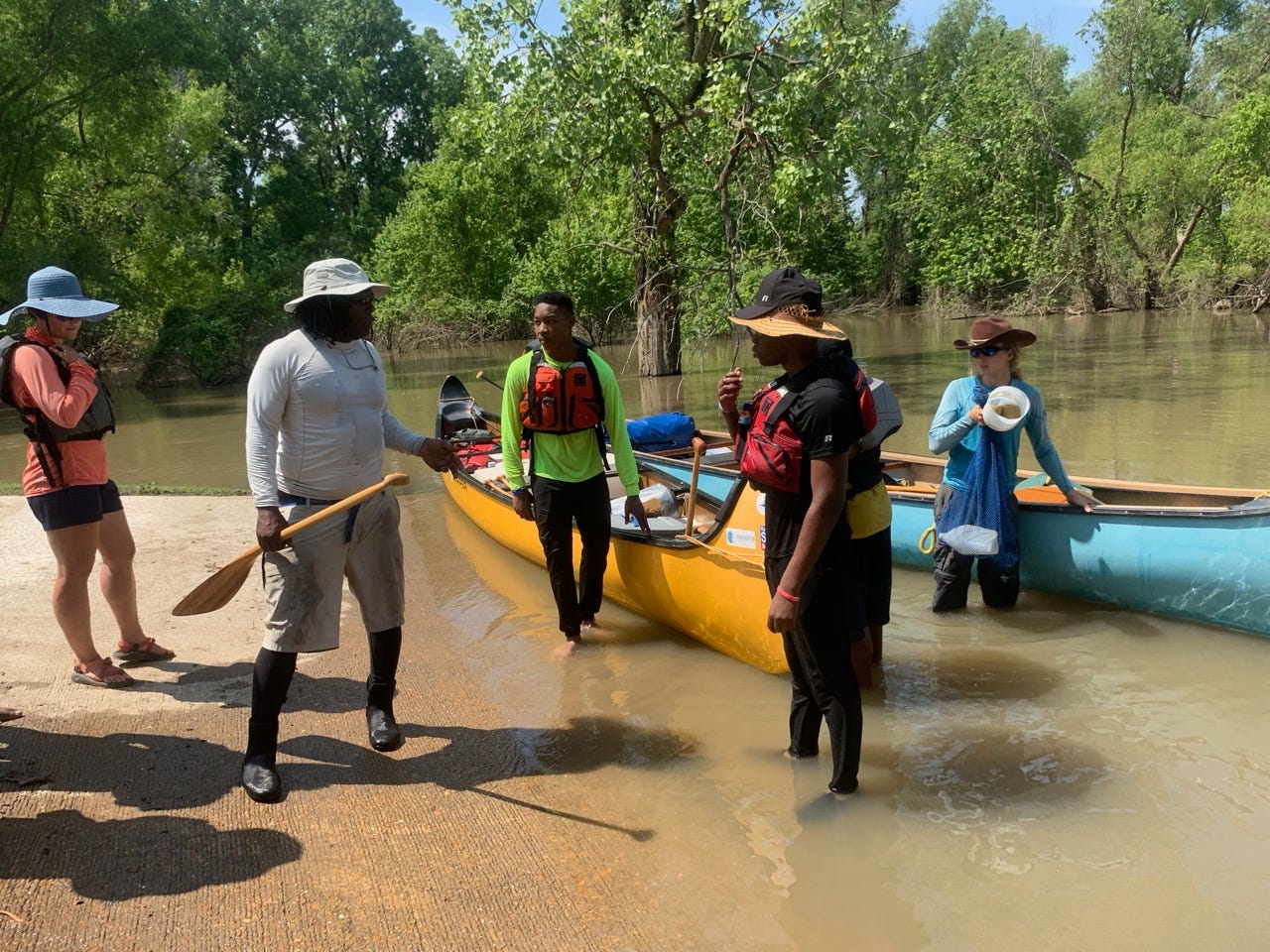
Itinerary:
Meet: 1pm
Big Boat Ramp in the Helena Harbor
Park your car near Boardwalk
(In the Helena River Park, over the levee from downtown Helena)

1pm: Helena Harbor
Intro Talk, Safety Talk
2pm: Arrive Buck Island
3-5pm: Explore sandbar
5pm: board canoe to return to Helena
6pm: arrive back in Helena Harbor

Trip is FREE for youth 18 or under, and 1/4 price for educators ($25 each).  1/2 price for all others, $50 each.  Payment in advance to hold seat.  See below for payment methods.

Please send responses to the following questions:
1) names of each person
2) cell phone contact of each person
3) approx weight (for choosing paddles and life jackets)

Payment in full by credit card or check to hold seat:

1) Automated Online Booking & Payment:
Click Here

2) Credit Card:
Paypal Billing (add 3% PP fee)
paypal.me/quapawcanoecompany

3) Venmo (add 3% Venmo fee)
John-Ruskey-1

Quapaw Provides:
Canoe, paddles, lifejackets and all necessary river gear, first aid kits, VHF Marine Radio, running lights, and all necessary emergency gear.   We’ll pack group water in 5 gallon jugs

Pack in Daypack or Drybag:
Each person should pack:
-waterbottles
-snacks
-sun protection
-bug protection
-shoes that can get muddy and wet (or go barefoot)

Optional:
-cell phone
-camera
-bird book
-binoculars
-swim gear
-towel

Note:
Pack any electronics in dry bag, dry box, or zip lock bags

Water Bottle Refill:
We’ll pack a 5-gal jug of water to refill your personal water bottles.

Wear:
Dress for weather. Wear shoes that can get muddy and wet (or go barefoot).
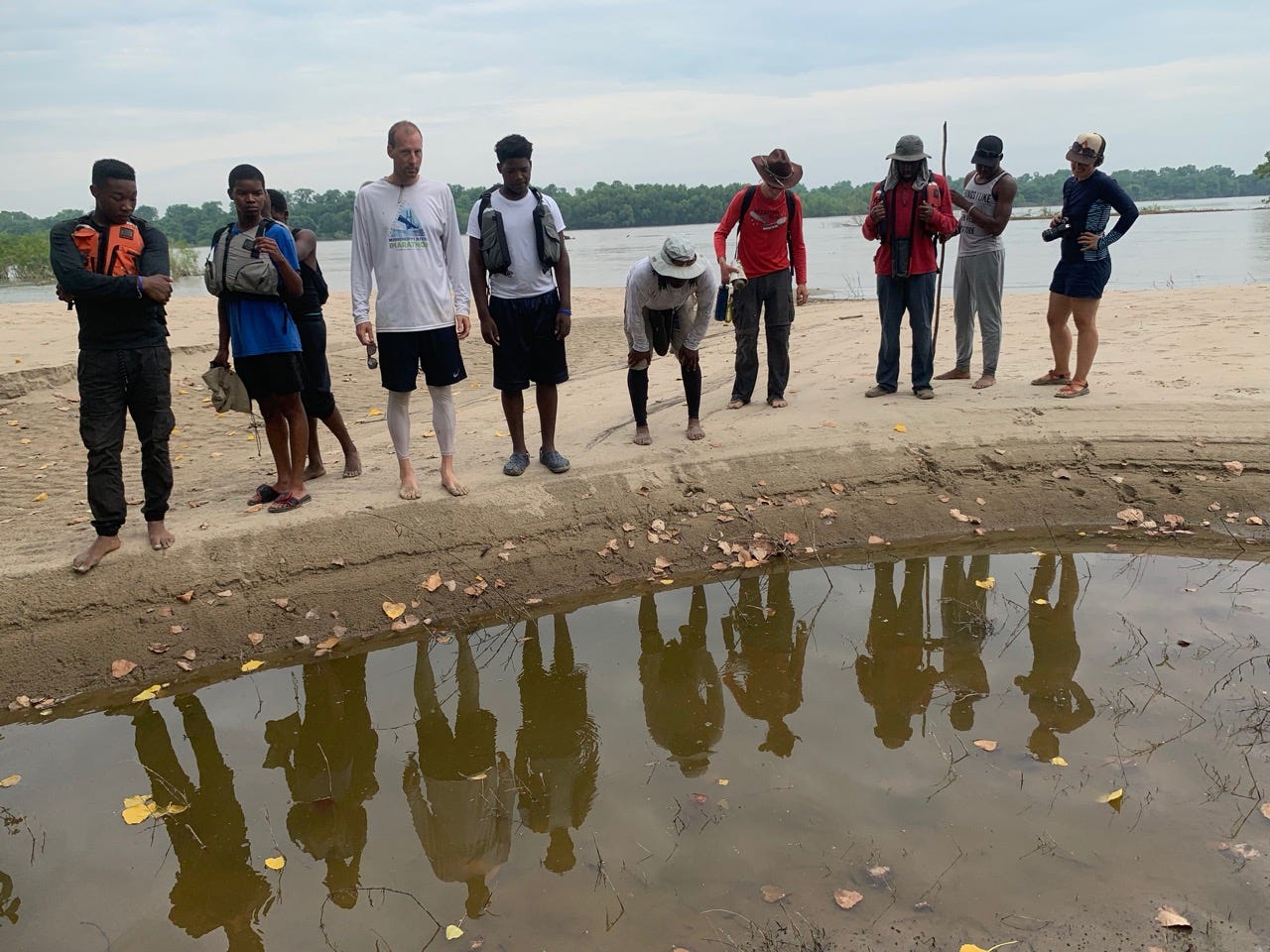
More about Buck Island:

Like all the big islands of the Lower Mississippi a wide variety of micro-ecosystems are found on and around Buck Island, including a bottomland hardwood forest, younger willow/cottonwood forests, small grassy fields, sandbars, gravel bars, blue holes, and muddy flood pools (left behind in the flats after high water), each with its own particular inhabitants and characteristics. It should be noted that the Lower Mississippi fluctuates 45-50 vertical feet in an average year -- as such much of the island and most of its habitats become covered with flowing river water at some point during a normal year. For instance, at high water the only portion of the island found above water is the mature floodplain forest and its isolated grassy areas.

For the paddler Buck Island is an ideal location for a picnic, an overnight camp, a base camp, or a voyageur’s camp (if you’re traveling long distance down the river). It can be approached easily from Helena via the boat ramp at the Helena Harbor (upstream paddling), or from above by putting in at the mouth of the St. Francis River. You can paddle to the sandbars, or into the forest. At low water there are huge sandbars to hike with limitless possibilities for tracking birds & animals, and an enormous gravel bar at the head of the island with great fossil-finding, rock hounding and beach combing. At med water you can sneak through hidden channels that bisect the island. At high water you can paddle into the forest and wander through the woods in your canoe or kayak. Infrequently, at the very highest of flood stages, the entire island goes underwater.

You can make landings in deserted alcoves, and swim in blue holes. You can paddle all the way around the island (circumnavigation) or make a simple approach, a quick landing, and then keep going.

Above the Island on the West bank (Arkansas shore) is a series of small islands to explore, as well as East bank (so called “Helena Islands” – Mississippi shore). You can enter a mature willow forest following old river at Trotter’s (East shore), at higher waters it is possible to work your way through the woods all the way up to Tunica Lake.

Driving Directions to Helena Harbor from Mississippi:

Directions to Helena Harbor from Mississippi: On US Hwy 49 North go across the Helena Bridge from Mississippi, and take the right turn 49B (Biscoe) into downtown Helena.  Follow Biscoe through a 4-way stop sign, and two lights. The second light is Perry Street. Turn right on Perry St. Head east past the “Doughboy” statue to the second stop sign which is Ohio. Follow the pavement on top of and then over levee, to where it dead ends at parking lot, in the Helena River Park.  Park vehicles and descend ramp for safety instructions, packing, and loading up canoes!

Boat Ramp in Helena Harbor GPS:
34.52196250015302, -90.58215559939534

Call me 662-902-7841, or Mark River 662-902-6479, if you’d prefer to talk!

We remain sincerely yours in service of the big river!

-John

John Ruskey
Quapaw Canoe Company
291 Sunflower Avenue
Clarksdale, MS  38614
662-902-7841
john@island63.com
Made possible through a partnership with the Lower Mississippi River Foundation. Dedicated to fostering long-term stewardship of the big river through its youth.
This looks like so much fun, John! I am looking forward to your visit!