


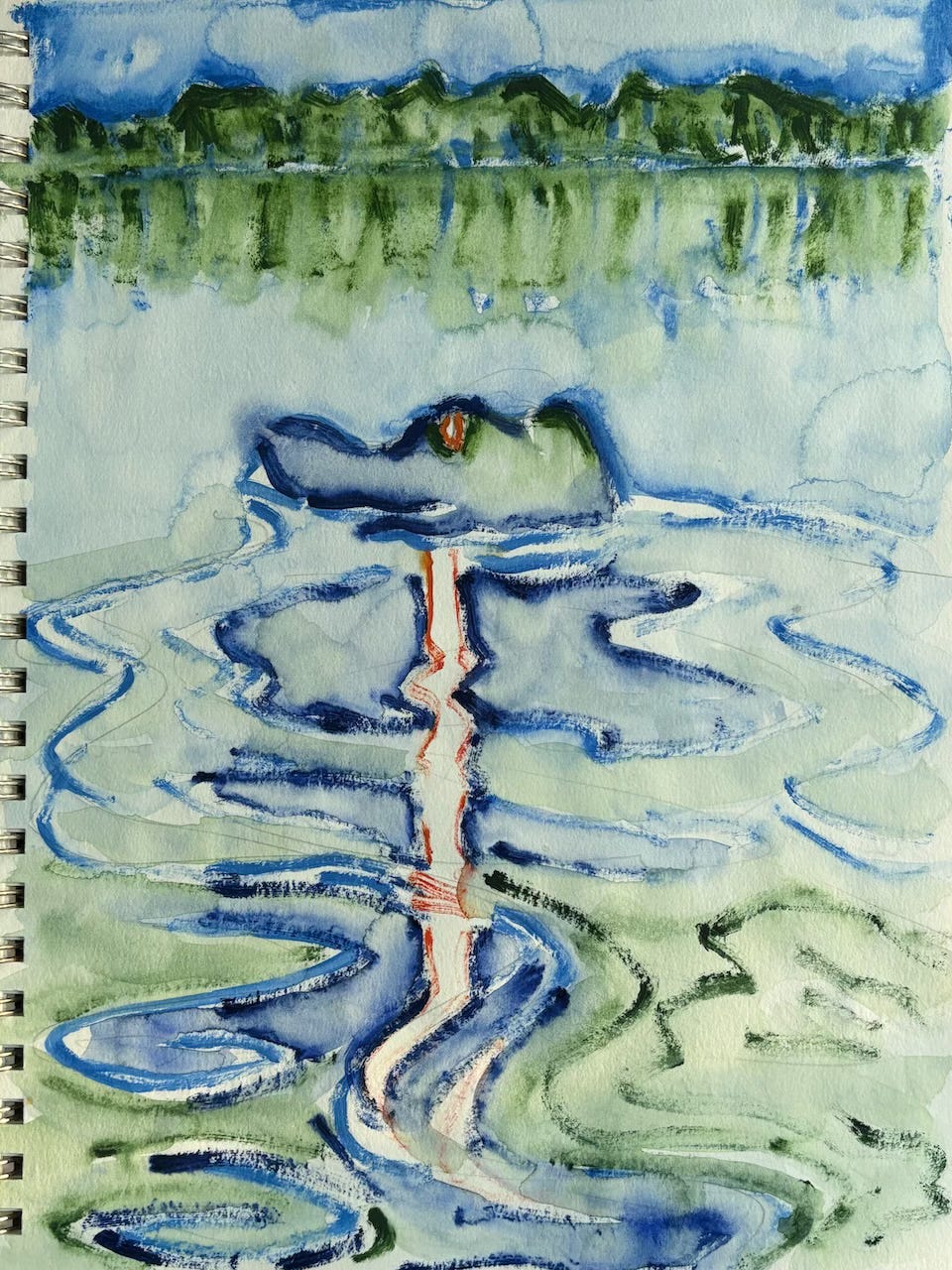
it's about to go crazy around here
Lower Mississippi River Report: Historic Rainfall leads to Historic River Rise

Advance note: call-out to artists for the LMRF Artist's Fundraiser Extravaganza:

Thursday, May 15th -- special once in a decade -- Artists Fundraiser for the Lower Mississipi River Foundation at the Cutrer Higher Education Center in Clarksdale, MS, in partnership with Coahoma Community College and Quapaw Canoe Company.  Featuring artists Robin Whitfield, Thad Lee, Rory Doyle, Lisa Webb, John Ruskey, and hopefully a few others.  Author Boyce Upholt will sign and donate Great River books to the cause.  Gallery talks, food and music.  This is a call-out to like-minded artists who would be willing to donate 50% of art sales to foundation programming (which includes annual summer Canoe Camp and monthly Community Canoe).

River Report: After three years of historic lows, and two additional years of sluggish rises, we are suddenly and unexpectedly experiencing the fastest and highest rise ever.  This too will be historic.  Strange how we seem to be see-sawing back & forth from extremity to extremity.  Maybe this is commensurate with the way the jet stream has been ducking & diving with increasing higher frequency loops?  Rainfall last week through this weekend is said to be a 1,000 year storm system.  Now that it's all on the ground, all that water is gathering in gullies and low places, and combining in creeks & streams, and then recombining again in small rivers and forming bigger rivers, and all slipping & sliding, and spilling over riverbanks on its way south, towards us, where it all gets concentrated like the mouth of a thousand mile wide funnel, and all comes together at the Ohio River Confluence, and follows this main trunk of the river we live on and operate from, the Lower Mississippi River, to toss & turn around endless looping bends, 954 miles from Cairo, IL, down to the open waters of the Gulf of Mexico.

Has anyone seen the river levels lately?  Our source is the National Weather Service River Forecast for the Ohio-Lower Mississippi Rivers.  Two thirds of our water is delivered by the Ohio at the Cairo Illinois Confluence.
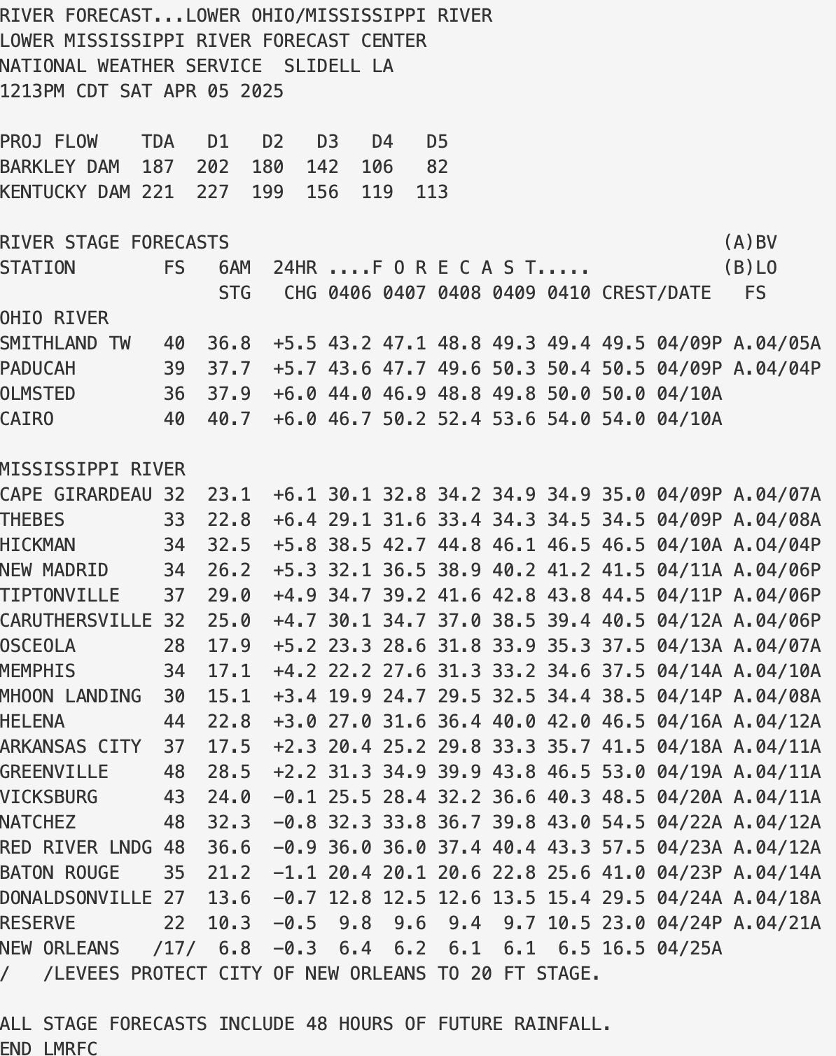
It's about to go crazy around here: 3-4 feet per day here for the next 10 days!  I'm guessing this is the start of what will probably be remembered in the future as a historic event.  Look at the above river gage.  This is a daily rendering, a very useful tool provided by NOAA's Nat'l Weather Service, updated every morning with latest data.  It takes into account 48 hours of forecasted conditions.  It is unparalleled in our river-rat world.  In one glance you can see what's happening on the last 954 miles of the river, with feeder info coming in from the Middle Mississippi as far as Cape Girardeau, MO, and  In one document you can

In the next week the river will rise 30 feet!  I've never personally witnessed such a fast rise.  Last week, just a couple of days ago, we dropped down to around 17 foot on the Helena gage, and the river seemed to be returning to drought levels.  Enter a super-charged atmospheric river flowing south to north off the Gulf of Mexico, scooping up continent sized swaths of moisture off the steamy waters, and delivering them in a week-long pathway of pummeling power over the belly of North America, the big valley drainage of the Mighty Mississippi River.  Everything has changed.

We use the Helena gage for closest observation.  According to above forecast (from Saturday) the Lower Mississippi at Helena rose 3 feet April 5th (22.8), and is going to rise 4.2 feet today (27.0), and then forecast to rise 4.6 feet on Monday (31.6), and an amazing 4.8 feet on Tuesday (36.4) -- (NOTE: I've never seen this fast a rise...  more typical is 1-2 feet per day during a rise, 2 feet is considered a fast rise, and sometimes 3 feet in extreme rainfall in one 24-hour period.  4-5 feet???  That's crazy fast!!!  Sobering.  Frightening.  Big time changes will happen quickly.  Beware wildlife, and anyone doing anything over the levee.).

And then starting to slow slightly 3.6 feet on Wednesday (40), and slower 2.0 on Thursday (42).   For now, the river is expected to crest at 46.5 April 16th.  But who knows what last night's heavy rainfall will add on to that?

Water levels just starting to bump here.  All the runouts & passes will be reversing direction, water flowing in.  All back channels are reopening.  The fish are happy, the coyotes and deer are nervous.  Wanbli bald eagle watches from treetops and waits for fresh meat opportunities.  Nothing radical in water levels and river speed today, but today is just the beginning.  The next couple of days this coming week will change everything.  Everything we are seeing now out on the river will be underwater.  For how long?  Who knows?  I am planning a long distance exploration in 2 weeks.  Memphis to Vicksburg at least.

Stay tuned.  We will be sending updates this week: We're heading out this morning for a celebration adventure with Boy Scouts Troop #1.  We'll be documenting everything, and will report back to you what's happening realtime as this historic event unfolds over our floodplain playing field.

PS: we like changes of water, the cycle of endless undulations up and down.  For us paddlers that means every time we go out we see something different every time we head out the door and over the levee.  Upswings push water into the adjoining wetlands, replenishing wet places, and downswings suck the water refreshened water back into main channel, rejuvenating the whole.  Especially exciting are the many "passes" and "runouts" that connect to backwaters.  The mouth of Tunica Lake, Mellwood and DeSoto are examples.  (see below photo montage for more examples).  Sometimes the shifts are so radical the water in these places runs outwards or inwards in a swift muddy torrent that create standing waves and hydraulics.  Sometimes waterfalls appear, over the jagged edge of rock piles (placed to maintain lake level behind).  Other excitements: high water replenishes all the fossil beds, and also the piles of driftwood.  It's like going to your favorite gift shop and finding the inventory completely renewed.  The water is cold.  Now in the low 50s.  Given the conditions wear wetsuit or drysuit if paddling solo canoes, kayaks or paddle boards.  The Lower Mississippi runs out of the North.  Most dangerous days are the warm ones when you get fooled into thinking Spring has arrived and you don't need to worry about it.

Lower Mississippi River Dispatch No. 964
"Voice of the Lower Mississippi River"
Vicksburg, MS ~ Memphis, TN ~ Clarksdale, MS ~ Wilson, AR
Quapaw Canoe Company ~ Celebrating 27 Years of Service ~
~Winner of the SBA 2024 Small Business of the Year Award~
Wow, that's crazy fast rise - how will this impact things in Clarksdale, and Quapaw's home?
I work on the Ohio River, on the Steamer Belle of Louisville. You all stay safe down there.