Jupiter & the Full Frosty Beaver Moon
If you can't join us on the Mississippi, watch the full frosty beaver moon and Jupiter rise side by side around sunset from wherever you are Sunday, Dec 15th - magical!
Lower Mississippi River Dispatch No. 950
"Voice of the Lower Mississippi River"
 Vicksburg, MS ~ Memphis, TN ~ Clarksdale, MS ~ Wilson, AR
Quapaw Canoe Company ~ Celebrating 26 Years of Service ~
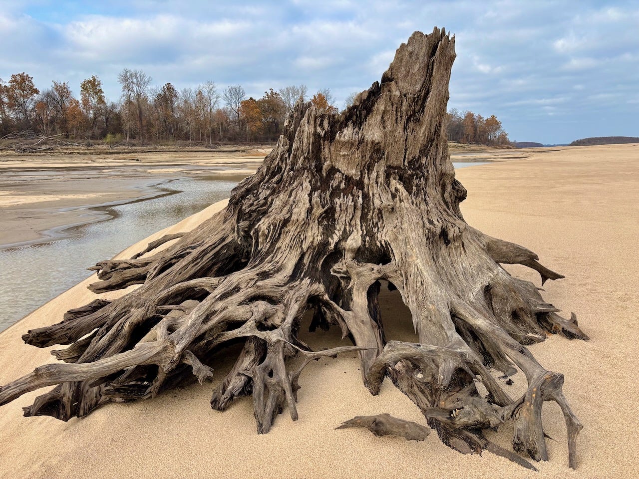
~Winner of the SBA 2024 Small Business of the Year Award~River Report: This week's rain is delivering a little bump upwards, keeping us out of the negative numbers. Although today the Mississippi River at Helena has dropped to 1.1 and forecast to fall one more day, down to 0.9, it will start rising again thereafter, but probably not too much until we get some significant ground saturating rainfall. When the Mississippi is below 5 in the Helena Gage, many landings are cut off completely, or end a pile of mud. Mhoon Landing: Unusable. Montezuma Landing: Unusable. Hillhouse: usable, but no access to main channel (the mouth of DeSoto Lake cut off by mud & giant pile of rip-rap opens up around 15 or so). What ramps are still open in our area? Try using the landings at Helena Harbor, Quapaw Landing, Terene Landing, Rosedale Harbor, Arkansas City Beebe Landing, and Greenville's Warfield Point. Current forecast predict that river will rise up a measly 4 feet by the beginning of next week.
Even still, the paddling is wonderful this time of year, when you watch the weather forecast and wear appropriate clothing, and pack extra emergency gear. Wetsuits are a must. Also pack extra food, water, and emergency overnight. Better safe than sorry. A thermos filled with your favorite hot beverage is awfully nice. There are no mosquitoes, and the night time skies are spectacular. Gemini's this week. Sunday night Jupiter will rise alongside the Full Frosty Beaver Moon (as we Mighty Quapawz call this one!). We'll be in slow motion for the next month, but can still offer trips for individuals or small groups if anyone
is interested. Respond to this mailer, or call 662-627-4070 for booking trip!
Sun Dec 15th from Helena, 2pm-7pm, Community Canoe, Full Frosty Beaver Moon (& Jupiter too!)
Helena, this one’s for you! Sunday, Dec 15th, meet 2pm at Public Boat Ramp near Boardwalk at Helena Riverpark. Round trip to Buck Island. Back after dark, around 7pm. Pack head lamp. Sunny and cool, high of 61, low of 54. Pack warm clothing, and rain protection also for possible showers. Advance reservations required. 6 minimum, 18 maximum. 1-6pm, $50 each, $25 educators, free for kids under 18 y/o. All paddle together, no previous experience necessary, but must be willing to paddle, and must wear life jacket! Made possible in partnership with the Lower Mississippi River Foundation. See below for complete details. First Come, first served. Respond to this mailer, or call 662-627-4070 for booking trip!
**Made possible by the deep, dedicated vision of the Lower Mississippi River Foundation
Click here for making your annual contribution — and help keep the dream alive!
What: Community Canoe daytrips are outfitted by Quapaw Canoe Company, presented in partnership with the Lower Mississippi River Foundation. Jump on board the big canoe and reconnect with the Mississippi River! This trip is open to anyone to sign up, and an opportunity to experience the pristine beauty of the Mississippi River wilderness. No previous experience necessary. Everyone paddles together in our big canoes with guides. Must be willing to paddle — sometimes hard paddling necessary.
Who: This trip is open to anyone! Come join us over the levee for some quality time with nature, friends, and community!
When: One Saturday each month.
Pricing:
Adults - $50
Educators - $25
Children under 18: free, accompanied by parents or guardians
Packing List
Each person should pack:
water bottle(s)
thermos with hot beverage
headlamp
snacks
sun protection (Hat sunscreen, sunglasses)
sandals/shoes that can get muddy and wet
Warm clothes as needed on Cool or Rainy Days:
gloves or mittens
scarf
warm hat
sweater or fleece
wind/rain jacket
Optional:
cell phone
camera
bird book
binoculars
Buck Island

Buck Island is a 1,498 acre island located 1 mile upstream of the mouth of the Helena Harbor. It is one of the big islands of the Lower Mississippi. At low water its sandbars stretch 5 miles north to south and 1 ½ miles east to west. The forested high ground of the island is approximately 2 miles tall and a mile wide, in kind of a half moon shape, with a smaller forested “splinter island” found to the east. (During low water this splinter island becomes joined to the main island by a wide valley of sand & muddy pools).

Like all the big islands of the Lower Mississippi a wide variety of micro-ecosystems are found on and around Buck Island, including a bottomland hardwood forest, younger willow/ cottonwood forests, small grassy fields, sandbars, gravel bars, blue holes, and muddy flood pools (left behind in the flats after high water), each with its own particular inhabitants and characteristics. It should be noted that the Lower Mississippi fluctuates 45-50 vertical feet in an average year — as such much of the island and most of its habitats become covered with flowing river water at some point during a normal year. For instance, at high water the only portion of the island found above water is the mature floodplain forest and its isolated grassy areas.

Helena & Buck Island sit at the base of Crowley’s Ridge 74 river-miles downstream of Memphis and 226 river-miles upstream of Vicksburg. Crowley’s Ridge is a 200-500 foot tall hilly ridge that parallels the St. Francis River north to the Missouri Ozarks, a geographic anomaly in an otherwise flat delta floodplain. Helena was built at the southern terminus of Crowley’s Ridge, a wise founding decision that has provided the city with consistent river access – while other Delta cities have been left dry (Greenville/Vicksburg) or had to retreat (Friars Point) from meandering ways of the Mississippi. Crowley’s Ridge creates an unusual hill-country environment with habitat for plants & animals not normally associated with the Delta (such as rhododendron and may apple). St. Francis National Forest begins at the Helena City limits with hiking, camping, birding, hunting & fishing. Helena & Buck Island are considered to be part of the Arkansas Mississippi Delta, both are found in between the mouth of the St. Francis and the Arkansas River. The Yazoo-Mississippi Delta is on the opposite shore (mostly within the State of Mississippi).

Due to its location on Crowley’s Ridge Helena is the only city in between Memphis and Vicksburg that actually sits on the main channel of the Mississippi River. This makes it an important resupply stop for long distance paddlers, and an ideal location for day-trippers or weekend adventurers who want to get a taste of the river. Anyone paddling the river along the Arkansas/Mississippi/Tennessee border will necessarily pass near or through Helena. Helena recently completed a beautiful park adjacent the main channel of the Mississippi with camping, walking trails, a boardwalk, and one of the best boat launches on the entire Lower Mississippi River. This new boat ramp is wider than most others, is good during all but the highest of river levels, and has good parking. Helena hosts one of the best blues & gospel festivals in the world every October, and is the birthplace and/or stomping grounds of many great blues musicians including Robert Johnson, Sonny Boy Williamson II, Robert Nighthawk, Junior Lockwood, Cedell Davis, Johnnie Shines, Frank Frost, Sam Carr, The Jelly Roll Kings & Lonnie Shields.

For the paddler Buck Island is an ideal location for a picnic, an overnight camp, a base camp, or a voyageur’s camp (if you’re traveling long distance down the river). It can be approached easily from Helena via the boat ramp at the Helena Harbor (upstream paddling), or from above by putting in at the mouth of the St. Francis River. You can paddle to the sandbars, or into the forest. At low water there are huge sandbars to hike with limitless possibilities for tracking birds & animals, and an enormous gravel bar at the head of the island with great fossil-finding, rock hounding and beach combing. At med water you can sneak through hidden channels that bisect the island. At high water you can paddle into the forest and wander through the woods in your canoe or kayak. Infrequently, at the very highest of flood stages, the entire island goes underwater.

You can make landings in deserted alcoves, and swim in blue holes. You can paddle all the way around the island (circumnavigation) or make a simple approach, a quick landing, and then keep going.

Above the Island on the West bank (Arkansas shore) is a series of small islands to explore, as well as East bank (so called “Helena Islands” – Mississippi shore). You can enter a mature willow forest following old river at Trotter’s (East shore), at higher waters it is possible to work your way through the woods all the way up to Tunica Lake.
Stay caught up on future community paddles on our Substack newsletter: quapaw.substack.com
Facebook page: facebook.com/QuapawCanoeCompany
By following, you’ll receive updates for our future community paddles and other exciting events at Quapaw Canoe Company!
Thank you for your attention to our beloved Momma Mississsippi! See you on the river!
**Community Canoe** and **Miss River Summer Youth Camps** are made possible by the deep, dedicated vision of the Lower Mississippi River Foundation (which many of you help support — thank you! — if you’d like to show your support for this little known but very efficient and effective non-profit organization, Please go here for making your annual contribution!)**


