
Lower Water 2022
Historic Lows on the Biggest River in North America

Lower Mississippi River Dispatch No. 886
"Voice of the Lower Mississippi River"
Memphis, TN ~Helena, AR ~  Clarksdale, MS ~ Vicksburg, MS

We’re in a record low fall year across the broad belly of America — creating a fascinating time to get out and explore — in many places discovering exactly what the bottom of the Mississippi River looks like, and what treasures lie there (previously hidden by muddy water).
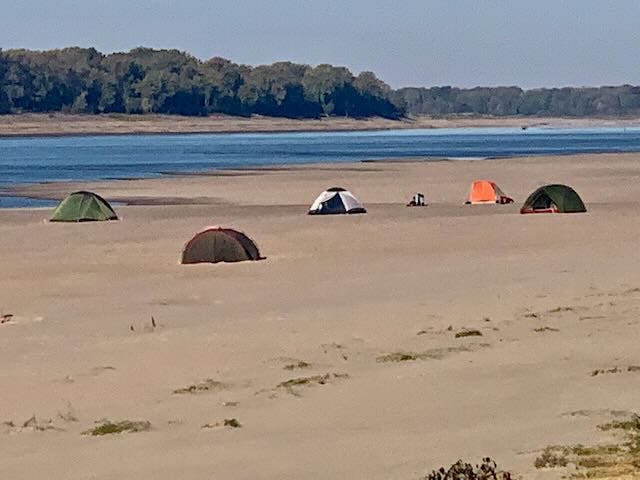
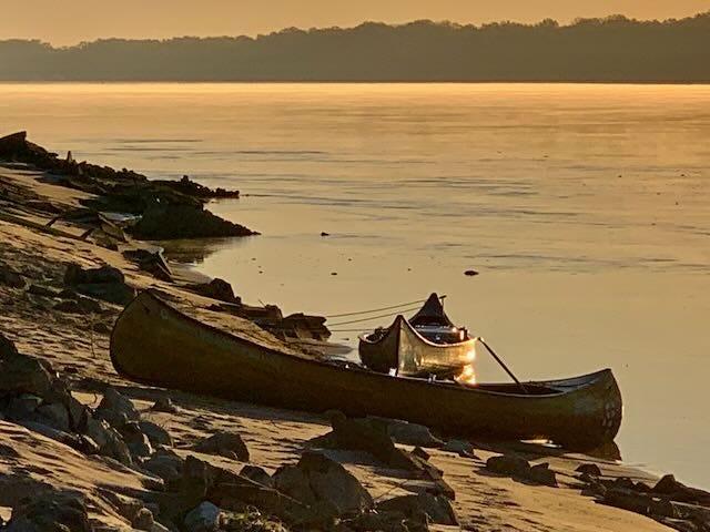
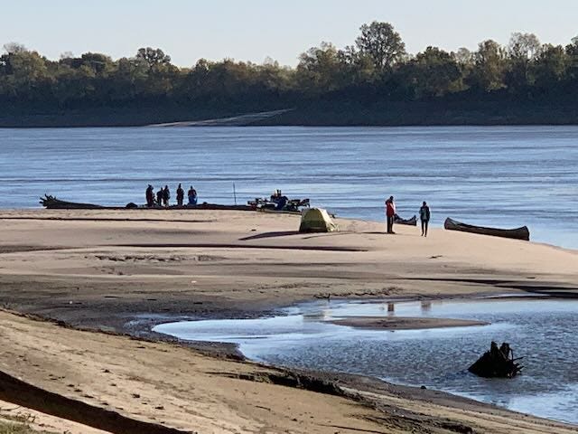
Giant sandbars that stretch off into the distance, the river is squeezed into narrow passages. We have the entire river to ourselves.
There is plenty of water for canoes, but shoaling in between deeper channels has caused groundings and snarls for big traffic. Thousands of towboats are pulled up and parked along the edges of the river, awaiting more water, or for dredging operations to be completed.
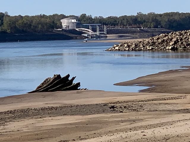
Low water has exposed a plethora of fossils, petrified wood, lithified mud, boat wrecks, ship wrecks — and giant tree trunks, like this 10 foot diameter ancient cypress stump.

Giant tree trunks are a reminder of the endless woods of our original forests. Teddy Roosevelt noted that the biggest trees in North America, outside of the West Coast, were found along the Lower Mississippi.

The long defunct Helena-Lula train ferry is fully exposed.
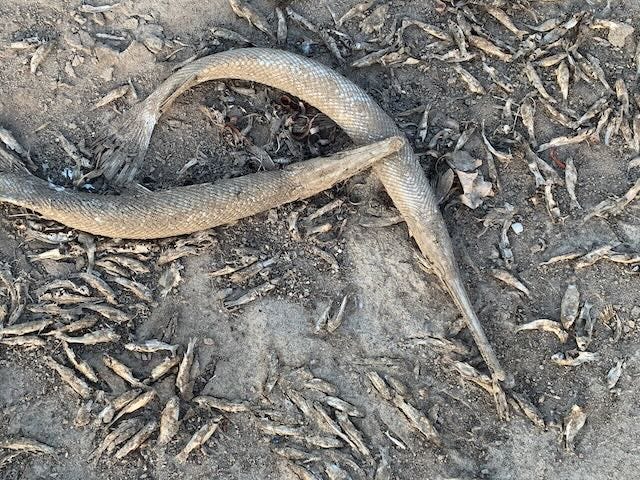
Fish are getting trapped in dried out back channels.
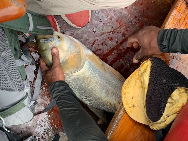
Other fish have nowhere to go, but leap into the air — and sometimes into the big canoe!
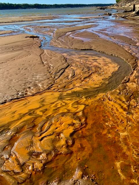
Strange colors are seeping out of depressions in the muddy banks, and sandbars, perhaps heavy metals, reminders of pre-1972 Clean Water Act industrial scale pollution which are normally covered over in higher waters.
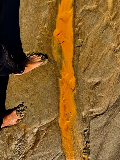
As a painter, this looks like cadmium yellow deep, the richest of yellows, a toxic element which drove some artists to go mad.
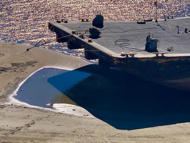
Landings are very difficult in some places.
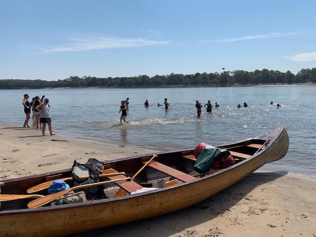
Easy in others.
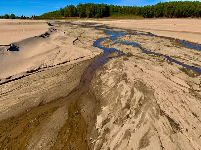
Fascinating landscapes have been carved into the sandbars, stretching off into and over the limits of vision (and the imagination), and over the curve of the earth, into distant wetlands, and previously water-filled back channels.
We’d love to share some low water river time with you!
~~~Now taking reservations for upcoming big water adventures: Horn Island Thanksgiving Artist’s Retreat, Nov 23-28, and two Community Canoe Daytrips, Sat Nov 26th and Sat Dec 17th~~~
~~~But we’ll get you out there anytime you want to go~~~Low Water Tours now available~~~Contact your closest base to plan your own custom-made adventure~~~Vicksburg: Layne Logue~~~ Memphis: Matthew Burdine~~~Clarksdale/Helena: John Ruskey~~~
If you go self-guided:
Downtown Helena Harbor and Quapaw Landing are still open and accessible by trailer. Most other landings do not reach the water. (For us paddlers, this is not a big deal, you can always portage!)
Lower Mississippi Low Water Boat Ramps:
As of this morning, you will have to portage your human-paddle vessels at Shelby Forest and Mud Island Upper ramp. The Big Ramp is narrowed to one single lane over the concrete edge into a pile of mud and rusty metal debris. 4WD only. Starr Landing not usable. Tunica Riverpark Landing is isolated by a muddy sandbar. Mhoon Landing ends in a ragged pile of ripped up revetment, rebar, stainless steel wire, and mud. Walnut Bend Landing the same, not usable. The steep concrete abruptly drops off a cliff into piles of rip-rap at Montezuma Landing. Dennis Landing (Hurricane Point) has been privatized, and is no longer open to the public at any water levels. Waiting to hear reports from Terene Landing, Rosedale Harbor, and Warfield Point. Yazoo River Landing in downtown Vicksburg is open and usable. Port Gibson: closed by mud. Natchez-Under-The-Hill: ends in muddy rip-rap. Baton Rouge Glass Beach Ramp: open but very rough & tumble access through torn up concrete slabs and rip-rap.
Lower Mississippi People & Paddlers: Please send reports (and photos) from your local ramp, and let us know if it is usable or not; also: how much higher the water will have to come to make it serviceable again! Thanks in advance.
Extraorinary images. It is hard to believe the river is so low!! Unimaginable from when I last saw it! Definitely a time to discover what lies beneath!!!
Beautiful narrative, John. That cypress is a wonderment. Washington Post just published an in-depth story of the drought conditions (https://wapo.st/3WnkVP6). Your photos would have enlivened the article quite a bit.