


Summer 2025 Mississippi Rivergator & Wild Miles Expedition
30-day expedition: July 15th to Aug 15th Ohio River to Gulf of Mexico

Summer 2025 Mississippi Rivergator & Wild Miles Expedition
30-day expedition: July 15th to Aug 15th Ohio River to Gulf of Mexico
(dates and route subject to change depending on prevailing water and weather conditions)

Open Seats in Voyageur Canoe:

This is an invitation to join us as an expedition member on Summer 2025 Mississippi Rivergator & Wild Miles Expedition.

You will be responsible for any personal transportation to and from expedition, and also for your personal camping gear and clothing, and your daily meal needs.  Quapaw Canoe Company (QCC) will take care of everything else.  QCC will provide canoes, paddles and life jackets, and all necessary safety & rescue equipment required for such an undertaking.  $100/day.  Join in by section, or join in for the whole thing.  Unparalleled glimpse of the heart and gut of America.  The wilds, and the industry.  The big river and the big islands.  Powerful waters, sublime waters.  All layers of creation, from microbiota through apex predators of the water, the land and the air.  Capacity: 6 minimum, 12 maximum.  First come first served.
Summary: Big canoes on the biggest river in North America. July 15th to Aug 15th Ohio River to the Gulf of Mexico in a 30-day expedition to update the Rivergator Paddler’s Guide to the Lower Mississippi River Water Trail and the Wild Miles Guide to the Wild Miles along the Middle and Lower Mississippi Rivers.  Dates and route subject to change depending on prevailing water and weather conditions.  All paddle together in hand-crafted voyageur style canoes.

1) Primary Purpose of Expedition: Updating the rivergator.org: along the way, we will be reading the one-million word Rivergator (published 2017) and observing any changes that might have occurred in the past 8 years.  One of your primary tasks aboard this expedition will be to provide a seasoned “second pair of eyes” to help note subtle (or not so subtle) differences between that described in publication, and that seen. Most important will be paddler-important subjects such as public landings, island campsites, and resupply access. Also of keen interest will be river conditions, main channel conditions, back channel access, navigation hazards, and navigation aids.  We will document wildlife along the way, especially any threatened or endangered species such as the pallid sturgeon and pocketbook musslehell.
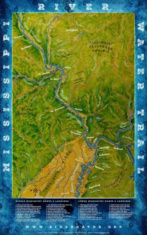
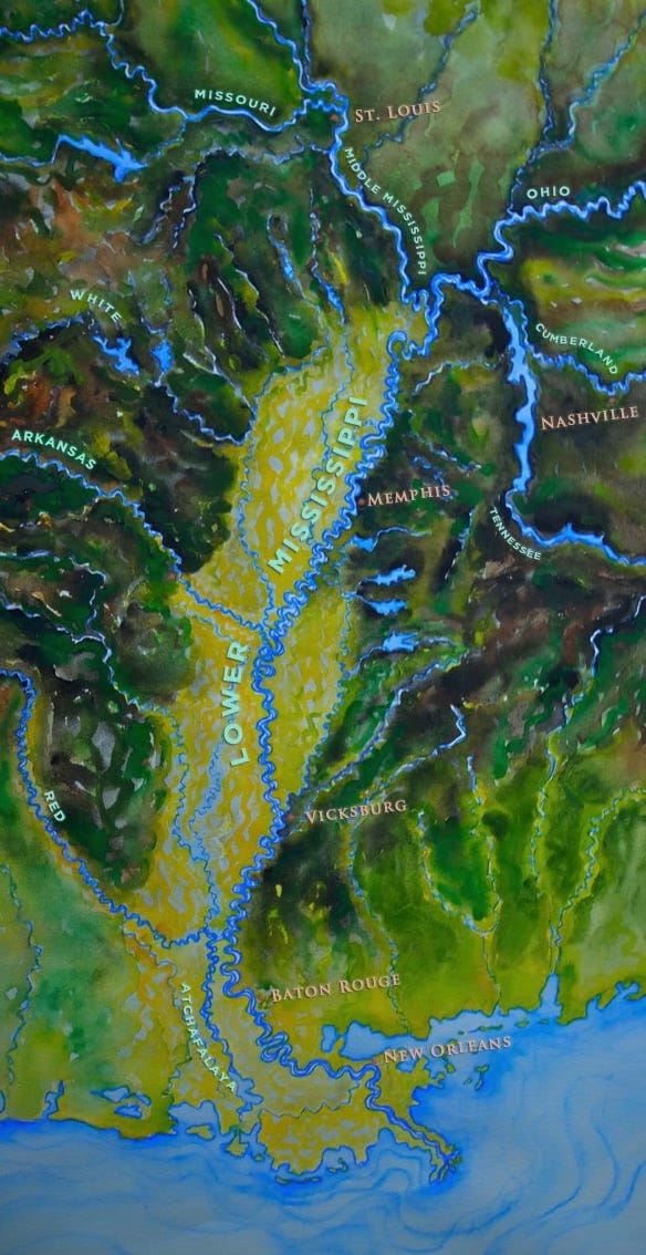
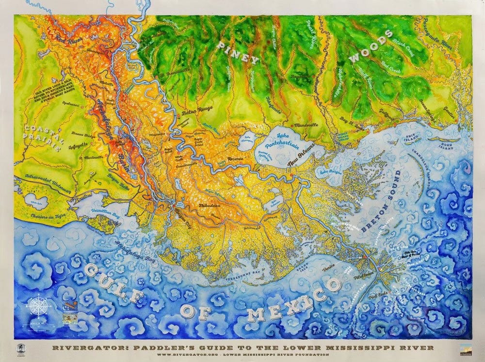
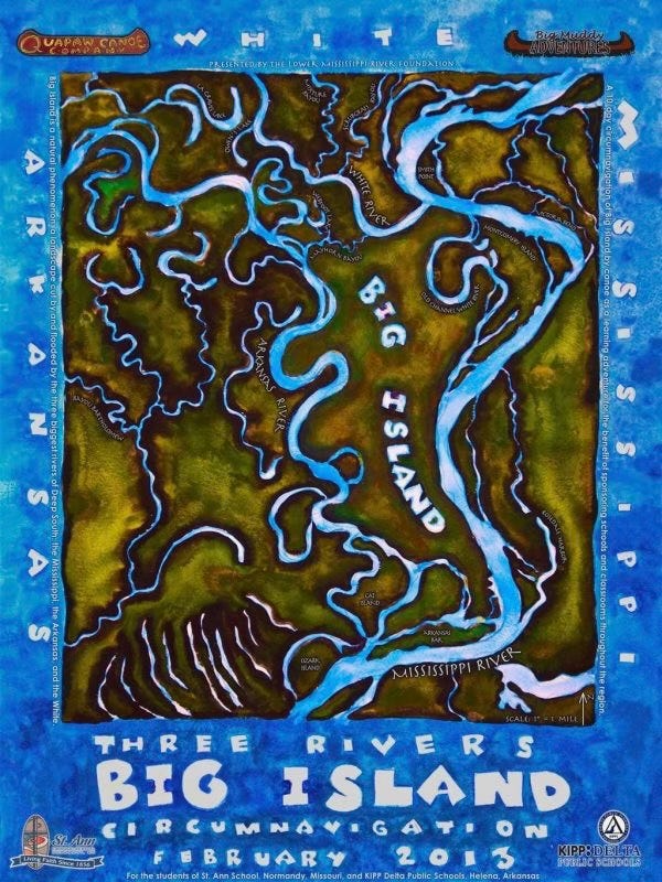
Note: The Rivergator is a mile-by-mile paddler’s guide written for canoeists, kayakers, stand-up-paddleboarders, and anyone else plying the waters of the Lower Mississippi River in human-powered craft.  The Middle/Lower Mississippi River creates the longest free-flowing water trail in the continental United States, 1154 miles from St. Louis to the Gulf of Mexico.  The name Rivergator is adopted from the best seller The Navigator first published in 1801 by Zadok Cramer, for pioneer Americans flooding the Ohio and Mississippi River Valleys.  The more recent Rivergator was created with the hope that Americans will rediscover their “wilderness within,” the paddler’s paradise created by the Middle Lower Mississippi Rivers.

Go to Rivergator

2) Secondary Purpose of Expedition: Updating Wild Miles: simultaneously, we will be updating the wildmiles.org listing the along the Middle and Lower Mississippi River.  Wild Miles are the places where nature predominates and nothing is seen of mankind save passing tows (and other river traffic) and maybe a tiny hunting camp or a single fisherman buzzing by in a johnboat.  These are places where the landscape is filled with giant islands bounded by endless mud banks & sandbars, where the river is overseen by big skies and where the sun sets uninterrupted by buildings or wires and where big river predominates with creative wild beauty, each high water results in shifting sand dunes and re-made sandbars.  This is a floodplain valley where only deer & coyote tracks are seen along the sandbars and enormous flocks of shy birds like the White Pelican and Double Breasted Cormorant are comfortable enough to make landing for the night.  These are places where it’s dark & quiet at night, where the stars fill the skies like brightly shining jewels poured out on a dark purple velvet blanket, almost as thick & vibrant as the night skies of the Great Plains or Rocky Mountains.
Wild Miles are the kinds of places that the 24 million paddlers in North America will travel long distances to enjoy, and we should preserve for future generations of Americans.  In sheer “wild value” the Lower Mississippi ranks alongside the Boundary Waters, the Allagash or the Okeefenokee.  The Lower Mississippi Water Trail is as important to our national identity and heritage as the Erie Canal, the Santa Fe Trail or the Appalachian Trail.  It has been travelled by millions of Americans including the Sioux, the Natchez, and more recently Abe Lincoln, John James Audubon, Walt Whitman, Langston Hughes and Rose & Jimmie Carter, and has always been our single most important route of migration & transportation.  It was the pathway north for freedom from slavery, and was the route taken by Huck & Jim in their timeless adventure.  It is the life blood of our nation flowing directly from the productive heartland through the cultural flowering of the south and into the vitality of the Gulf of Mexico.

Read More About Wild Miles Here

We are identifying these Wild Miles as the focus for future preservation and as the places where new industry & agriculture installations should not be placed. One single smokestack could corrupt the feeling of wildness for miles upstream or downstream.  Wild Miles describes the Middle and Lower Mississippi River mile-by-mile with photos, videos and audio clips. Our goal is to document the Wild Miles, and compare the Wild Miles with the Not-Wild Miles (Industrialized or otherwise).
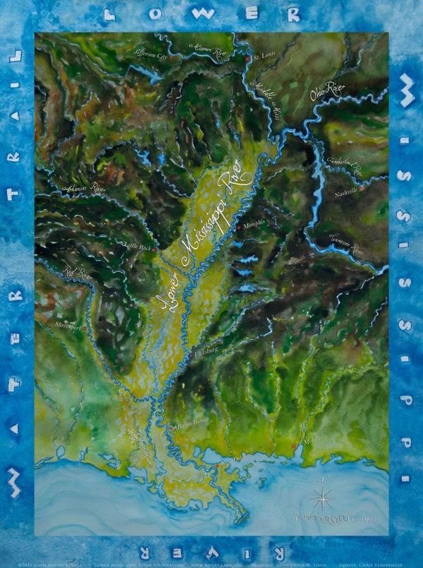
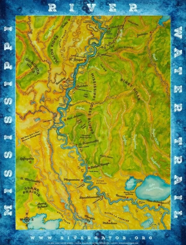
Route: Meet and start expedition at Ohio River Confluence, paddle into the wide confluence of the Ohio River, (muddy waters swirling into green waters), through Hickman KY, New Madrid, MO, Caruthersville, MO, and Memphis TN.  Onwards downstream through Helena, AR, Greenville, MS, Lake Providence, LA, and Vicksburg, MS.  Paddle by Natchez, MS, and then into Louisiana, through St. Francisville, Baton Rouge, Plaquemines, New Orleans, Port Sulphur, Venice, and then follow South Pass to final destination Gulf of Mexico.  Camp on Gulf beaches, then turn around and paddle back up to Venice for ground transportation back home.

Daily Schedule: Voyageur style.  Early wake ups, pack up and get on river by 6am.  Paddle and explore 5 hours.  Maybe one hour lunch at noon.  Paddle and explore all afternoon.  Camp around sunset.  We will probably average 10 hours/day of paddle time in the canoe.  This expedition is all about exploration, discovery, and sharing. We like to stop and explore along the way.  So when there are interesting sites to see, we stop a lot, maybe once every hour for a 15 min to 1/2 hour (maybe as long as 2 hour or even half day if schedule allows) walk or hike for documentation, or tracking, bird watching, beachcombing, swim, or whatever.  Lunch is usually an hour.  Also, a mid-day nap sure feels good on the river!  There is room in the itinerary for flexibility… so if the weather is bad, or the crew is worn out, we might stay on shore one full day (storm camp), and each person will be at leisure to do as they please. On the other hand some days we be “voyageur-style” and stay in the canoe longer (maybe 2-3 hours at a time for a total of 12-16 hours of paddling) to make distance, or because of approaching winds or storms, and a good bomb-proof camp is needed to weather it out.  There might be night time paddling as necessary to avoid wind, or make timely landings.
Camping: Remote islands, sandbars, towheads, usually sandy places, sometimes it’s necessary to make a muddy landing.  In inclement weather it might be necessary to find shelter within the forest.  This is primitive camping on a river island, no services of any sort.  Bring everything you need to make yourself comfortable.  Bring your own toiletry.  Bring a change of warm clothing, including summer months, when mornings can be cool.  It’s always cooler on the river.

Camping equipment and heat protection:  You will need a tent with lots of ventilation, and also a lightweight sleeping bag, a pad, and several changes of sun protective clothing. Extreme summertime heat & humidity. Cool down with swims in the river, shady siesta sites, shady campsites, and splashing water over yourself. Stay hydrated.  Drink lots of water and mix in electrolytes, or citrus alternatives.
Sun Exposure: be prepared for everything from heavy rain to hot days with intense sun UV exposure!  Sunlight is surprisingly strong on the river, even in the winter (you get the sun twice – once from above and once reflected from below).  Sunburn is our number one complaint and has caused more than one Mississippi River paddler very painful days and sleepless nights.  Be forewarned!  Sunglasses, sun screen, long sleeve clothing and a wide brim hat are all good ideas, especially for anyone particularly sensitive.

End Note: please respond via email reply if you have any questions.  I will provide detailed itinerary, as well as what to pack and what we provide, as well as other materials relating to the subjects at hand.  Thanks for your interest in joining us to help identify and signify the biggest and wildest river in North America.

Sincerely yours in service,

John Ruskey
Owner, Quapaw Canoe Company
Author of the Rivergator and the Wild Miles
Founder, Lower Mississippi River Foundation
Lower Mississippi River Dispatch No. 984
"Voice of the Lower Mississippi River"
Quapaw Canoe Company ~ Celebrating 27 Years of Service
Custom Guiding & Outfitting on the Lower Mississippi River
Winner of the SBA 2024 Small Business of the Year Award
Hello, is the $100/day a cost to the crew, or payment for the crew?